Route schematization with landmarks
Keywords:
schematic map, geovisualization, cartographic generalization, route map, wayfinding, landmarks, spatial cognitionAbstract
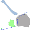
Predominant navigation applications make use of a turn-by-turn instructions approach and are mostly supported by small screen devices. This combination does little to improve users' orientation or spatial knowledge acquisition. Considering this limitation, we propose a route schematization method aimed for small screen devices to facilitate the readability of route information and survey knowledge acquisition. Current schematization methods focus on the route path and ignore context information, specially polygonal landmarks (such as lakes, parks, and regions), which is crucial for promoting orientation. Our schematization method, in addition to the route path, takes as input: adjacent streets, point-like landmarks, and polygonal landmarks. Moreover, our schematic route map layout highlights spatial relations between route and context information, improves the readability of turns at decision points, and the visibility of survey information on small screen devices. The schematization algorithm combines geometric transformations and integer linear programming to produce the maps. The contribution of this paper is a method that produces schematic route maps with context information to support the user in wayfinding and orientation.
Downloads
Published
Issue
Section
License
Copyright (c) 2020 Marcelo de Lima Galvão, Jakub Krukar, Martin Nöllenburg, Angela Schwering

This work is licensed under a Creative Commons Attribution 4.0 International License.
Articles in JOSIS are licensed under a Creative Commons Attribution 3.0 License.
