Mining sensor datasets with spatiotemporal neighborhoods
Keywords:
spatiotemporal patterns, data mining, sensors, spatial neighborhoods, spatial clustering, discretization, change detection, spatial autocorrelationAbstract
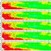
Many spatiotemporal data mining methods are dependent on how relationships between a spatiotemporal unit and its neighbors are defined. These relationships are often termed the neighborhood of a spatiotemporal object. The focus of this paper is the discovery of spatiotemporal neighborhoods to find automatically spatiotemporal sub-regions in a sensor dataset. This research is motivated by the need to characterize large sensor datasets like those found in oceanographic and meteorological research. The approach presented in this paper finds spatiotemporal neighborhoods in sensor datasets by combining an agglomerative method to create temporal intervals and a graph-based method to find spatial neighborhoods within each temporal interval. These methods were tested on real-world datasets including (a) sea surface temperature data from the Tropical Atmospheric Ocean Project (TAO) array in the Equatorial Pacific Ocean and (b) NEXRAD precipitation data from the Hydro-NEXRAD system. The results were evaluated based on known patterns of the phenomenon being measured. Furthermore, the results were quantified by performing hypothesis testing to establish the statistical significance using Monte Carlo simulations. The approach was also compared with existing approaches using validation metrics namely spatial autocorrelation and temporal interval dissimilarity. The results of these experiments show that our approach indeed identifies highly refined spatiotemporal neighborhoods.
Downloads
Published
Issue
Section
License
Copyright (c) 2013 Michael Patrick McGuire, Vandana Janeja, Aryya Gangopadhyay

This work is licensed under a Creative Commons Attribution 4.0 International License.
Articles in JOSIS are licensed under a Creative Commons Attribution 3.0 License.
